Wednesday, April 1, 2009
Tuesday, March 17, 2009
Houston as an artist community
The following images diagram the proximity of artist based information in the Inner-Houston area. The rings emanating from the site denote distance (1 mi, 3 mi, 5 mi, 10 mi). All diagrams include bus routes as dispersed by the transit center on site.
 Neighborhoods with large concentrations of artists
(North- The Heights
South- Montrose)
 Art Museums
(Art Car Museum, Contemporary Arts Museum, Museum of Fine Arts, Menil Collection, Rothko Chapel, Station Museum of Contemporary Arts)
 Galleries
All information combined
Saturday, March 14, 2009
2ND REVIEW: March 10, 2009
In the beginning I studied relationships in transitional phases from a fabric to a model of a highway. The study was not about the beginning or end, but about the space between. The ends were what seemed unnatural. Throughout the study, there was a constant struggle in mitigating scale and speed- this is also a constant struggle in the city.
This is essentially the core of my project: Designing between, on, around, over, and under the highway and working with it and its neighbors existing systems by:
- Breaking down edges
- Connecting (potentially) across the “river”
- Oozing and flowing loosely through a set structural grid.

Feedback from the review
- Understand loop as tension and diversion. There is an intensity of connections in certain moments THEN an incredible discovery of the underbelly.
- Can we propose new uses for these spaces?
- Cathedral of the 21st Century. Set it up as a stage- anything can happen here.
- Give a new reading to this site. Create an armature to allow different things to happen.
- Floating Cafés
- This is a destination and about moving back and forth across a highway.
- Series of diagrams talking about threshold, filter, subject, designation. A gathering from all sides. Diagram all the scales within and test them out. Diagram the dynamics of urban systems- who is coming here? Water?
- Is it one moment or parallel moments?
- What is on both sides?
- Where are points of gathering?
- There are already flows- how to divert, capture, filter these flows?
- Model- changing forest- urban landscape- how do we navigate through these spaces?
- Think about sound. So much water when it rains. What is a flooded forest? There are certain universals and certain things that are specific to
- Seasonal changes in terms of use
- How do you build off a field or forest?
- Impose methodology- build the thing so we understand its complexity. Series of sectional models.
- Stephen Holl- edge of city project
- How do you decide what to do now? Radius, loops, or outside narratives could start to inform this.
- Forest, flooding ,access to sky—if it were a building, what does it need to do to negotiate neighborhood and forest- a building that’s porous, survives flooding, and allows people movement.
- Gateway into the city- a “rest stop” into city.
- Phenomena of light and dark.
- Observatory- amplifying or reaction to spaces. Be tactile.
- ….Choose a juicy program.
Saturday, March 7, 2009


Friday, March 6, 2009
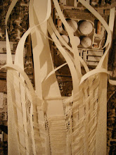
site model photos
Field Conditions
 The space as perceived on the ground without the highway overhead.
 The space as perceived on the ground without the highway overhead.
 The great divide
(before the addition of trees and structure)
Thursday, February 26, 2009


Wednesday, February 25, 2009

Wednesday, February 18, 2009
“Surface quality of material, that is matière, being mainly a quality of appearance, is an aesthetic quality and therefore a medium of the artist; while quality of inner structure is, above all, a matter of function and therefore the concern of the scientist and engineer. Sometimes material surface together with material structure are the main components of a work; in textile works for instance, specifically in weavings or, on another scale, in works of architecture”
-Anni Albers, a weaver from the Bauhaus
Sunday, February 15, 2009
SPEED, MOTION, AND SPACE: Wintersession in Review
Motion happens in a traceable path that is seldom repeated in the same way or at the same speed. My Degree Project will explore the spatial effects of the convergence of these speeds and paths as well as their deflections.
THE BEGINNING
 Thresholds and transitory moments between objects of varying speeds were the original interest manifested in last semesters DP Probe. The probe was a conceptual exercise in transitioning a knit fabric into a highway interchange system. More specifically, my interest was in transportation systems (in this case the Houston highway), and how they integrate into the city, what I termed the City Knit. A knit fabric is made of one piece of continuous yarn that serves as both structure and infill. The study presented two ways to move forward with the project: to inhabit the highway infrastructure, or to step back and study transition zones.
RESEARCH AND ANALYSIS
For the first study I chose to look at Houston, Texas- the 4th largest metropolitan city in America. The city has very informal zoning laws so that I could study the spatial ramifications of building a highway through a largely residential city center. There is nearly an anything goes policy with zoning, so it is such a product of it's surroundings. Houston highways operate through two concentric rings, with a third one under construction. The density of the city disintegrates as urban sprawl takes hold further away from downtown. The following graphic compares the scale and highway systems at work in Los Angeles, Boston, Houston, Chicago, and Portland. Los Angeles operates with a grid overlaid on the city, Boston with one primary thoroughfare (now below ground), Chicago with a finger-system, and Portland with a loop-esque system.
 Possibly because of the devastatingly hot and humid weather that occurs 9 months out of the year, or just because of Houstonian's reliance on their vehicle, the car culture that occurs there is quite different than other cities. In fact, the highway operates more as a thick wall than as an interruption. There are certain neighborhoods where neighborhoods continue on both sides of the highway, while some do not break through the barriers of large commercial streets or shopping centers.
  I chose to study the inner loop, Loop 610, as it encompasses the Port of Houston, the Galleria (huge high-end shopping district), downtown, and Memorial Park.
  Motion in a city relies on two different grains, often opposing but sometimes operating in tandem. On a highway, there is the path which the vehicle moves. It is directional and at points it must transition from fast to slow to stopped. In the other direction there are the spaces adjacent to the highway, directly affected by this motion corridor. The following study demonstrates the program adjacent to the highway.
While the colors indicate the different zones, such as commercial, residential and industrial, they also demonstrate speed. The darkest blue (residential) demonstrates a slow pace. The act of moving through a residential neighborhood is deliberate and intentional and the act of getting there is separate from the act of being inside. In addition, the streets are narrower and the nature of the space calls for you to move slower. The streets are organized based on space maximization and efficiency with a rigid structure that is characteristic and often iconic of a residential neighborhood. This color indicates a destination.
The lightest blue (commercial) demonstrates a quick pace. There is a constant flux in activity at varying speeds. This zone is important as it does not mark a final destination. It is an ephemeral space where the space between is just as important. There is a spectacle involved with moving through commercial zones. This color indicates sequence.
The above image also diagrams the highway transition zones (when a road passes under/over and the highway edge at those moments- raised with hill/raised with wall/on ground/raised for passage *see sections below) The graphs below demonstrate where these transitions occur with the most frequency.
 Looking at these conditions as sections and figure ground drawings, you notice the different treatments of the highway as an edge and how each zone reacts to it. In each setting there is somewhat of a "buffer zone".
 The most interesting was the final section (corresponding with figure ground E) where the highway breaks into a lesser, but still large and quick road. The space between this road and the highway is just large enough to fit a few large commercial buildings into the space. In this specific condition, the building is only 55 feet from the edge of the highway. However, the highway at this point has broken apart into several pieces and layers. This fragmentation and dispersion of speed/density is what allows the building to remain so close.
 The following chart demonstrates the distance from the highway edge. Surprisingly, residential neighborhoods were consistently built the closest to the edge of the highway. These numbers are directly relational to the way each zone uses the highway or the roads that feed onto it. Both commercial and industrial zones use these corridors heavily for both access and transport of materials. There is also generally a thick band of parking along this edge. Residential zones treat the space completely different, however, as there is a barrier of trees and/or fences before the backyard begins. Access to these homes is not from the highway or feeders. There is a sequential order that one must experience before arriving, generally a series of roads descending in both speed and size.
 CASE STUDIES
 Glass Video Gallery, Bernard Tschumi:
The first three diagrams demonstrate view. Regardless of destination, path or intention in the gallery, the view remains constant--the shared "path" (visible yet uninhabitable) unites each inhabitant. The visitor can choose to stray from this view. Vision is mapped through cones and angles rather than the specific lines of destination. This implies that it is possible to inhabit the project visually before physically moving through the space.
The second set demonstrates path. Similar to the Houston study, there are two specific types of inhabitants in a building. There are those who are visitors (curious, timeless) moving at a slower pace, and there the constant frequenters of the space (determined, intentional) moving much quicker.
Parc de La Villette, OMA (competition entry):
As mentioned in an earlier post, there are two types of circulation, the Boulevard and Promenade. These paths represent the two types of inhabitants mentioned above, but at a park scale. The Boulevard connects with the rest of the city and serves as an urban thoroughfare. The two paths are joined by a riverside ambulatory, so that the circulation system forms a figure 8. To meander on the promenade, one will be recycled back into the larger path in order to reinvigorate his pace.
The circulation of this version of the park is not as clearly defined as the previous. In fact, it is similar to the layout of an actual city. A city is divided into several different types of roads and paths.
Primary (highways, expressways)- high speed, control of access
Secondary (arterial roads)- somewhat control of access
Tertiary (local roads)- leading off a main road, smaller scale, slow paced
Quaternary (alleys)- pedestrian use, fills in-between space.
Carpenter Center, Le Corbusier
As displayed by the "Pure Geometry" diagram, the building mass is articulated by three major geometric forms. The cube in the center serves as a mixing ground between the two, while the other two forms belong to their corresponding street, Prescott or Quincy. In the "Axes" diagrams, the crossover between the two outer forms is very deliberate as the interior of the building is incredibly lacking in corridor space. The circulation is open and free until you transition to another mass.
Le Corbusier transitions the inhabitant into his building by:
- offset (from the streets. Subtle and moving in the same direction)
- shift (change from an urban orientation to building orientation)
- incline/decline (gradual slope of the ramp)
FEEDBACK FROM THE REVIEW:
- Fabric: In the initial studies, there was a misstep: the city is actually analogous to a woven fabric as there are many different parts that are constantly changing.
- Consider a double or triple weave, where the fabric pulls apart and you build up the space between.
- What you pull to the surface is what determines the condition of the fabric. There are convergent systems that are somewhat dependent. Fabric looks like it is overlaid but there are intersections.
- In a knit, if you break one piece, the whole thing will fall apart. In a weave, when altered it morphs and adjusts.
- Consider deflection vs. transition.
- Transport systems- analogous to fault lines
- All movement systems are connective- the richness is in the moment of overlapping. At what point is our movement opportunistic?
- Start occupying space: splitting apart, splitting open?
- Drawings: more sections (zoom in) and photographs. Hierarchical readings of levels and analytical drawings.
- Moving forward: create diagrams of the site to show the intersection of the different systems.
- Cut into the ground.
- Study water and electricity and how they are treated in different zones (industrial v. residential).
- Spend more time on the sections.
- Form an attitude about the way the city is constructed- develop a mapping technique.
Case studies:
- La Villette- the canal is also an important means of movement through the park.

MOVING FORWARD:


Sunday, February 8, 2009
CASE STUDY: PARC DE LA VILLETTE, OMA (competition entry)

The park has to major elements of circulation:
Boulevard: (For the purpose of destination, high-speed route by comparison)
- Runs north-south, systematically intersecting all the bands at right angles.
- Directly connects the major architectural components for the park (museum/baths in north, City of Music/Great Hall in the south).
- This is corridor is the 24-hour part of the program as it hosts the all-night facilities located on or along it. Distances itself spatially but stays visually connected to the busy public life along the perimeter.
- Width: 25 meters wide, 5 of which are covered.
Promenade: (For the purpose of discovery through meander, low-speed winding route)
- “Journey along the promenade will represent a fragmented visit to them all”
- Generated through the identification and demarcation (through plazas) of certain significant cross sections as they are fortuitously created through the interaction of the bands.
- Creates access to small sites within the site- small destinations at each plaza (chess tables, small amphitheatres, greenhouses, etc.)
- Entrances coincide with (and control) the opening of the park itself.
The two paths are joined by a riverside ambulatory, so that the circulation system forms a figure 8. To meander on the promenade, one will be recycled back into the larger path in order to reinvigorate his pace.

Tuesday, February 3, 2009
CASE STUDY: Bernard Tschumi, Glass Video Gallery

The Glass Video Gallery was commissioned by the city of Groningen and the Groningen Museum as a public pavilion for watching music videos. It is at the center of a traffic roundabout. Within the glass volume are six banks of video monitors.

Monday, February 2, 2009
PRECEDENT: Charles Downing Lay, highway system (1935)
Most highway interchanges systems, like the "T" crossing and the cloverleaf, were designed to provide uninterrupted speed and increased safety through simple grade separations and entry ramps. In 1935, landscape architect Charles Downing Lay proposed an usual merger of highway interchange and community. In Lay’s formulations, the limited-access highway was a protocol for recombining new and old roadways as well as means of appropriating land for different kinds of development. Given several separated lanes of traffic, direction could be assigned to each lane on an alternating basis according to traffic flow. Through independent alignments and the possible divergence of the two roadways, Lay also proposed to incorporate existing roadways and create parks within the irregular spaces between them. Exurban communities might also be site between separated roadways that were approximately a mile apart. The roadways would meet again for important bridges or intersections. The several hundred feet insulating the roadway would provide a kind of greenbelt around the small community.
“Switching intelligence became less important than optimizing larger networks of movement”

Sunday, February 1, 2009
TEXT: Image of the City, Kevin Lynch
The image of the city is a composite of all the senses in motion, according to Lynch. These senses will be based on legibility and environment (identity, structure, meaning). Lynch serves to uncover the role of form in the city—“it is taken for granted that an actual design form should be used to reinforce meaning, and not to negate it”
ELEMENTS OF THE CITY:
- PATHS: channels along which the observer moves. The predominant organizing elements of their city image- people observe their city while moving through it.
- While continuity is both desired and expected in paths, there is a directional quality as well. This can be done through gradient—regular change in some quality which is cumulative in one direction (most frequently sensed gradients are topographic or use in intensity). A prolonged curve is also a gradient.
- Paths with clear and well known origins and destinations had stronger identities, helped tie the city together, and gave the observer a sense of his bearings whenever he crossed them.
- Identity: “Where major paths lacked identity or were easily confused one for the other, the entire city image was in difficulty”
- EDGES: not to be considered as paths—linear breaks in continuity.
- While continuity and visibility are crucial, strong edges are not necessarily impenetrable. Edges can also serve as uniting seams, rather than isolating barriers.
- Example:
- DISTRICTS: two-dimensional extents of the city which are recognizable as having some common identifying character.
- NODES: points or strategic spots in the city—they may be primarily junctions, places of a break in transportation, a crossing or convergence of paths, moments of shift from one structure to another. Also called cores.
- LANDMARKS: another type of point reference—usually a rather simply defined physical object. Symbolize a constant direction.
**The image of the city can shift its type with difference circumstances of viewing.
“When we consider more than one path, then the path intersection becomes vital since it is the point of decision” “Because decisions must be made at junctions, people heighten their attention at such places and perceive nearby elements with more than normal clarity—elements located at junctions may automatically be assumed to derive special prominence from their location”
QUALITIES OF FORM
- Singularity
- Form simplicity
- Continuity
- Dominance
- Clarity of joint
- Directional differentiation
- Visual scope
- Motion awareness
- Time series
- Names and meanings
Saturday, January 31, 2009
TEXT: The Freeway in the City
 Communities shaped by rapid transit facilities such as subways or other rail lines are likely to be linear-narrow, densely populated strips based on shortness of walking of busing time to transit stops. In contrast, freeway-oriented communities, using the automobile for transportation, are usually more widely spaced and open. The two opposing community types should be inter-related only with great care.
 Even in America few cities have consistent grid patterns, but are, rather, comprised of series of grids. Freeway alignment, at best, will respond to each grid series. Sufficient right-of-way should be acquired, where feasible, to provide transitional areas, sometimes in the form of green parklike boundaries between the adjacent street patterns.
TEXT: What Time is this Place? Kevin Lynch
(Includes the development histories of: London (after 1966 fire), Bath , Stroke on Trent (Industrial England), Ciudad Guayana (Venezuela ), Havana
“The loss of information increases as the rate of development rises, particularly as our technology now encourages us to make massive alterations of the earths surface for rural as well as urban uses”
PASSAGE OF TIME:
- Rhythmic Repetition: heartbeat, breathing, sleeping and waking, hunger, the cycles of the sun and the moon, the seasons, waves, tides, clocks.
- Progressive and Irreversible change: growth and decay, not recurrence but alteration
TIME:
- Grain- size/precision of chunks into which it’s divided
- Period- length of time within which events recur
- Amplitude- degree of change within a cycle
- Rate- speed at which changes occur
- Synchronization- degree in which cycles/changes are in phase or begin/end together
- Regularity- stability/unchanging
- Orientation- degree to which attention is focused on past, present, and future.
- Sequence- order in which they are seen adds to the pleasure of the experience
MANAGING TRANSITIONS:
Change:
- Growth/decay
- Simple redistribution
- Alteration in intensity
- Alteration in form
- Disturbance followed by restoration
- Adaptation to new forces
- Willed change
- Uncontrolled change
“The species of change is so unpleasant and dispiriting that we neglect it as a technical problem” “Environment can teach its users about the nature of change or give them a chance to cause it.”
ARTICLE: “The New Exploration: Charting the Industrial Wilderness” by Benton MacKaye
In this article MacKaye (the individual discussed in Easterling’s text), writes about rethinking the organization of the industrial United States using metaphors like “mouth” and “source”, and considering the efficiency of communication and lines of flow within.
On creating paths: The job is not to make the most efficient route. It is already made by nature—it lies there, a hidden potentiality. The job is to discover it. To do this the engineer must search for it—he must explore. His first job, then, is not construction but exploration.
TEXT: Organizational Space, Keller Easterling
Terms used in the discussion of mapping or recording interplays as well as articulating adjustable organizational protocols (used as markers of active process):
Benton MacKaye [later worked under FDR to help design the highway system]
Mackaye treated a site as a set of interdependent parts within which small shifts in balance or orientation had an enormous effect. Through a series of texts and articles he discussed frequently the act of “visualizing” as influenced by American transcendentalists Emerson and Thoreau. Visualizing depends on a reliance on the use of memory and eidetic perceptions and charting of the potential now existing in the actual.
 MacKaye’s Appalachian Trail, a 2000 mile footpath up the Eastern Seaboard that he described as a transportation project. He proposed no master plan but rather an ordering principle for a new economy. This footpath was the dominant infrastructure that would organize streets and rails. In doing this he inverted the conventional hierarchy of transportation and development. He located the trail along side the mountain ridge, with the ridge becoming the central spine of development. This replaced the tall buildings of the metropolis and reversing its dominant pattern of concentric growth.
To show sequence as a map is impossible—perceptions involve more than simply visual contact with the scenery. Passage in his trail enveloped the individual in a motion picture experience with a script that was consciously compiled, stored, and reconstituted.
In 1927 MacKaye toyed with the idea of creating a new map, charting activity rather than territory. This type of map allowed him to highlight the protocols of activity and exchange within an environment. Which were often pliable and filled with new sites and opportunities.
 MacKaye reorganized land through mapping and revealing new territory within it. This developed what MacKaye calls “Terra Incognita” or “Environment”—territory essentially discovered within a new arrangement of perceptions.
Remote
Redundancy
Parallel
Differential
Switch
Governor
Partition
Function
Summation
Subtraction
Redundancy
Parallel
Differential
Switch
Governor
Partition
Function
Summation
Subtraction
Benton MacKaye [later worked under FDR to help design the highway system]
Mackaye treated a site as a set of interdependent parts within which small shifts in balance or orientation had an enormous effect. Through a series of texts and articles he discussed frequently the act of “visualizing” as influenced by American transcendentalists Emerson and Thoreau. Visualizing depends on a reliance on the use of memory and eidetic perceptions and charting of the potential now existing in the actual.
“And so with planning generally: the final thing planned is not mere area or land, but movement or activity.”
 MacKaye’s Appalachian Trail, a 2000 mile footpath up the Eastern Seaboard that he described as a transportation project. He proposed no master plan but rather an ordering principle for a new economy. This footpath was the dominant infrastructure that would organize streets and rails. In doing this he inverted the conventional hierarchy of transportation and development. He located the trail along side the mountain ridge, with the ridge becoming the central spine of development. This replaced the tall buildings of the metropolis and reversing its dominant pattern of concentric growth.
To show sequence as a map is impossible—perceptions involve more than simply visual contact with the scenery. Passage in his trail enveloped the individual in a motion picture experience with a script that was consciously compiled, stored, and reconstituted.
In 1927 MacKaye toyed with the idea of creating a new map, charting activity rather than territory. This type of map allowed him to highlight the protocols of activity and exchange within an environment. Which were often pliable and filled with new sites and opportunities.
 MacKaye reorganized land through mapping and revealing new territory within it. This developed what MacKaye calls “Terra Incognita” or “Environment”—territory essentially discovered within a new arrangement of perceptions.
PRECEDENT: Rem Koolhaas, new town of Lille, France (2004)

According to Koolhaas, 'old' architectural principles (composition, scale, proportion, detail) no longer apply when a building acquires Bigness. This was demonstrated in OMA's scheme for the development of "Euralille" (1990-94), a new centre for the city of Lille in France, a city returned to prominence by its position on the new rail route from Paris to London via the channel tunnel. OMA sited a train station, two centres for commerce and trade, an urban park, and 'Congrexpo' (a channel tunnel contemporary Grand Palais with a large concert hall, three auditoriums and an exhibition space).
Congrexpo, is the centerpiece for the plan. One large exterior wall is built of thin corrugated plastic flecked with tiny pieces of aluminum. This surface creates a hard, reflective shell on the outside, but from the interior the wall is translucent.


The building flows with the subtle curves which are a Koolhaas hallmark. The main entry hall has a sharply sloped concrete ceiling. On the exhibition hall ceiling, slim wood slats bows at the center. A staircase to the second floor zigzags upward, while the polished steel side wall slopes inwards, creating a wobbly mirror image of the stairs.

From Rem Koolhaas: "Lille has been shot to ribbons by the French intellectuals. The entire city mafia, I'd say, who call the tune in Paris, have renounced it a hundred per cent. I think that was partly because it has had no intellectual defence." (The Critical Landscape, by Arie Graafland and Jasper de Haan, 1997)

The most provocative space is created by simply subtracting the separations among the several infrastructure networks at their crossing--functions as a passenger exchange.
PRECEDENT: Brian Richards and Warren Chalk- City Interchange System (1966)
 Chalk and Richards designed a superstructure to handle exchange between four different transit systems in Britain. Through the integration of these four systems, the result was a fifth.
PRECEDENT: Frank Lloyd Wright- Broadacre City


Broadacre is a continuous metropolitan region of low density. Areas designated to serve similar purposes are allocated functionally (parallel along traffic systems of more than regional importance like monorail and motorway): trade, entertainment, industry, agriculture, housing etc.. Arrangements are selective - idealized - but not exclusive.
The city starts with the single family house. Due to Broadacre's economical logic it is being built by oneself (in a DIY network). Using standardized elements and partly prefabricated building modules it is fairly extendable (in Wright's terms "organic"). But first of all it is affordable, although money has almost no relevance in Broadacre.

The notion of an aircraft in everyone's front yard is a convincing image. Total mobility is inevitable.
The road is a symbol of individual freedom. Cars aren't simply contemporary or modern, they represent democracy itself. The technology to cross and to communicate long distance facilitates:
air, light, and freedom of movement.
 Wright designed interchanges within the context of Broadacre City designs, and like most interchanges, his designs provided continuous movement through grade separations. Wright's interchange was a monolithic landscaped structure, however, bermed into the ground by its underpass and designed to include a partially covered walkway so that it provided its own spatial enclosures rather than merely a crossing between two highways.
Subscribe to:
Posts (Atom)